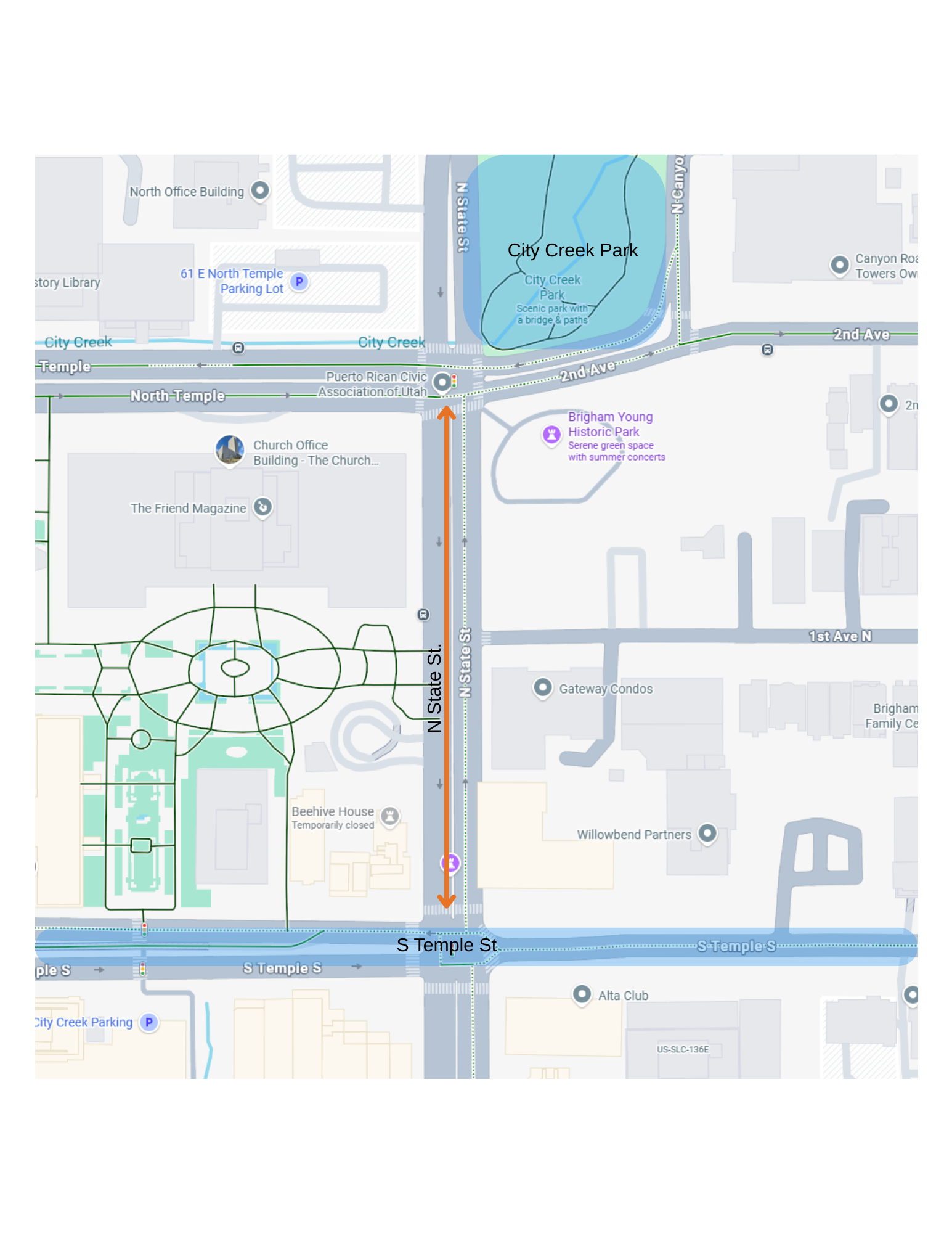
Group 1-Capstone Project: N. State St., City Creek Park to S Temple
Working together in your group, please explore this area on bike or on foot. Your group will collaborate to develop a concept(s) for a safe and comfortable active transportation connection(s) from this area to existing bicycle and pedestrian infrastructure. The goal is to increase bicycle and pedestrian safety and connectivity from City Creek Park to S Temple on N. State St. During construction of the new temple, have safe detours for active transportation users been installed with signage that is clear? What does the transition at N State St and S Temple S look like for someone on bike or on foot that would like to travel east/west?
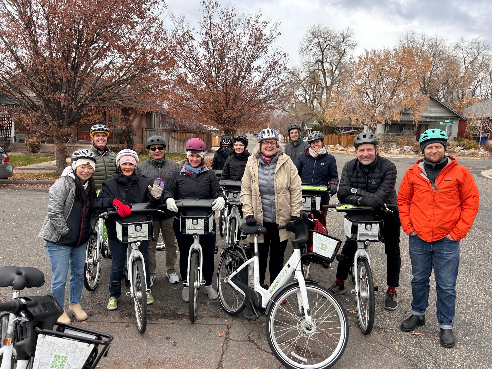
The connection should take into consideration people of all ages and abilities. While you are exploring the area, what types of users do you observe? Are they different genders, ages, are people sitting or walking? If they’re walking, are they in a hurry, or leisurely walking? How is the public right-of-way being used?
Steps to consider for the Capstone Project
1) See Building a Bicycle/Pedestrian Network below. For this exercise, you are focusing on Steps 1) Identify and Step 2) Choose Facility Type.
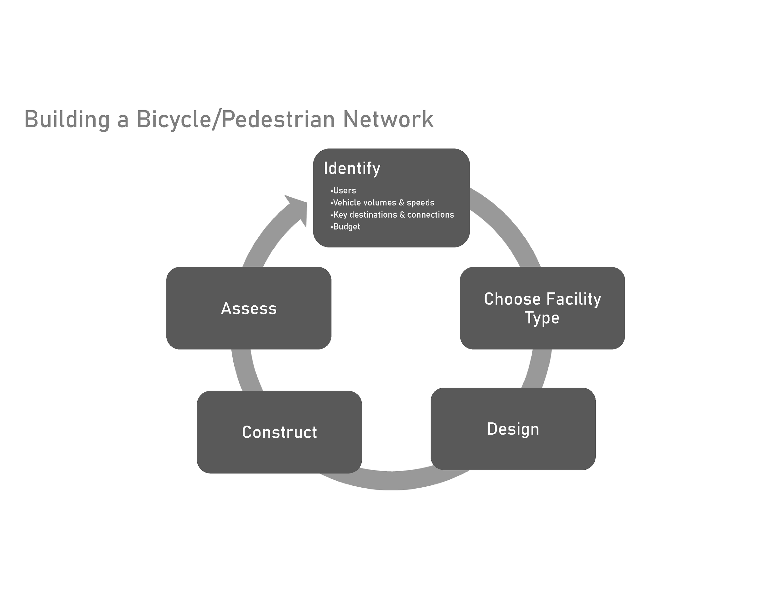
2) Identify
a) Start with a desktop review using Google Earth or Google Maps and identify key destinations within ~.50 mile radius of the origin.
b) What are the current transportation connections from the origin to the intended destination?
c) How wide are the existing sidewalks, sidepaths, bike lanes, greenways, etc.?
d) Are there any accessibility concerns, and if so, what are they?
e) Are there buffers? If so, how wide are they?
f) Do marked crossings exist (midblock and/or at intersections)?
g) Are the current conditions safe, comfortable, and connected?
h) What is the Average Daily Traffic of the road/s?
i) Is there a history of crashes at the project location or along the route/s to the destination?
j) Average vehicle speeds. (If data is available)
k) What is the posted speed limit?
l) Amenities- Amenities can make a corridor or area go from feeling unsafe to safe. They also can enhance the quality of life by making a space feel more comfortable, convenient, and enjoyable. What amenities exist and what type of amenities can be added? Examples:
i. Lighting
ii. Benches
iii. Proper signage/wayfinding
iv. Is there bike parking near front doors
3) Field Visit
a) Walk/bike the existing and suggested new route/s (if applicable).
b) What additional information did you gather from the in-person visit and experience of the current infrastructure?
4) Choose a facility type and design
a) How does your recommended facility (or facilities) improve safety, comfortable, and connected?
b) What other design safety countermeasures do you recommend? (See binder)
c) Is a road reconfiguration feasible and advisable?
d) Will additional ROW need to be acquired?
e) Is the new design for all ages and abilities?
f) Will there be changes to parking?
5) Assessment of the project
a) After the project has been constructed, how should it be assessed for effectiveness?
b) What data points will be evaluated?
c) What is the timeframe?
You have an available budget of $1,250,000.
Average cost for Shared Use Paved Paths: $350 per linear foot.
Estimated costs notes:
Average cost of Protected Bike Lanes: $150 per linear foot.
Average cost of sidewalks: $125 per linear foot.
Average cost of Bicycle Boulevards/Shared Roadways: $100 per linear foot.
Rectangular Rapid Flashing Beacon(RRFB): $50,000
High-Intensity Activated Crosswalk (HAWK) Beacon: $150,000
Raised Crosswalks: $50,000
You will need to develop the routes/solutions via Google Earth or another mapping tool that will show the route and identify specific infrastructure elements (Examples of various elements which could be utilized: Shared-use paved paths, sidewalks, simple street design modifications, traffic calming, pavement markings, bike lanes…), street/highway crossings, and potential obstacles.
You will present your concept(s) and justification to the full group as if you are presenting to a City Council or Commission and seeking approval to allocate funding for the project. Please develop a presentation in Powerpoint or other presentation app (Canva) that can be broadcast onto the screen in our meeting room. The presentation should include:
1) Who is on the team, and their roles with the project team?
2) Any public outreach that occurred in the design process?
3) Who were the stakeholders the team talked to?
4) Are there demographic or vulnerable population concerns the city needs to consider?
5) Current conditions
6) Project recommendations
a. Type of facilities
b. Cost
7) What safety issues or concerns will the new project address?
8) How will the project be assessed?
9) Sensitivity to government spending and overreach
Schedule:
10:00am: Group assignments and project background
10:30am: Depart for site visit
12:00 pm: Return to WFRC and develop presentations in conference room. Lunch will be delivered at -12 pm.
1:45pm-Presentations begin